Wednesday, June 4, 2008

Happy World Environment Day, 5th June


World Environment Day (WED) was established by the United Nations General Assembly in 1972. WED is hosted every year by a different city and commemorated with an international exposition through the week of June 5. The United Nations Environment Programme (UNEP), also created in 1972, uses WED to stimulate awareness of the environment and enhance political attention and public action.
"Stockholm was without doubt the landmark event in the growth of international environmentalism," writes John McCormick in the book Reclaiming Paradise. "It was the first occasion on which the political, social and economic problems of the global environment were discussed at an intergovernmental forum with a view to actually taking corrective action."


WED 2008

The host for World Environment Day 2008 will be New Zealand, with the main international celebrations scheduled for Wellington. The slogan for 2008 is "CO2, Kick the Habit! Towards a Low Carbon Economy." New Zealand was one of the first countries to pledge to achieve carbon neutrality, and will also focus on forest management as a tool for reducing greenhouse gases.[2] The Chicago Botanic Garden will serve as the North American host[3]for World Environment Day on June 5, 2008. The daylong celebration will feature activities for everyone in the family along with presentations by local and national organizations in the areas of food, shelter, energy, education, transportation, and public awareness.
A website has been set-up by the ministry of education nz to support in-school initiatives. efs.tki.org.nz. It encourages school pupils to make short term and longer term pledges to minimize emissions. The list of pledges can be found on a typical school profile's page


Previous host cities


World Environment Day celebrations have been hosted in the following cities:[4]
2007 - Tromsø, Norway
2006 - Algiers, Algeria
2005 - San Francisco, U.S.
2004 - Barcelona, Spain
2003 - Beirut, Lebanon
2002 - Shenzhen, People's Republic of China
2001 - Torino, Italy and Havana, Cuba
2000 - Adelaide, Australia
1999 - Tokyo, Japan
1998 - Moscow, Russian Federation
1997 - Seoul, Republic of Korea
1996 - Istanbul, Turkey
1995 - Pretoria, South Africa
1994 - London, United Kingdom
1993 - Beijing, People's Republic of China
1992 - Rio de Janeiro, Brazil
1991 - Stockolm, Sweden
1990 - Mexico City, Mexico
1989 - Brussels, Belgium
1988 - Bangkok, Thailand
1987 - Nairobi, Kenya

Previous themes

2008 - Kick The Habit - Towards A Low Carbon Economy
2007 - Melting Ice – a Hot Topic?
2006 - Deserts and Desertification - Don't Desert Drylands!
2005 - Green Cities – Plan for the Planet!
2004 - Wanted! Seas and Oceans – Dead or Alive?
2003 - Water – Two Billion People are Dying for It!
2002 - Give Earth a Chance
2001 - Connect with the World Wide Web of Life
2000 - The Environment Millennium - Time to Act
1999 - Our Earth - Our Future - Just Save It!
1998 - For Life on Earth - Save Our Seas
1997 - For Life on Earth
1996 - Our Earth, Our Habitat, Our Home
1995 - We the Peoples: United for the Global Environment
1994 - One Earth One Family
1993 - Poverty and the Environment - Breaking the Vicious Circle
1992 - Only One Earth, Care and Share
1991 - Climate Change. Need for Global Partnership
1990 - Children and the Environment
1989 - Global Warming; Global Warning
1988 - When People Put the Environment First, Development Will Last
1987 - Environment and Shelter: More Than A Roof
1986 - A Tree for Peace
1985 - Youth: Population and the Environment
1984 - Desertification
1983 - Managing and Disposing Hazardous Waste: Acid Rain and Energy
1982 - Ten Years After Stockholm (Renewal of Environmental Concerns)
1981 - Ground Water; Toxic Chemicals in Human Food Chains
1980 - A New Challenge for the New Decade: Development Without Destruction
1979 - Only One Future for Our Children - Development Without Destruction
1978 - Development Without Destruction
1977 - Ozone Layer Environmental Concern; Lands Loss and Soil Degradation
1976 - Water: Vital Resource for Life
1975 - Human Settlements
1974 - Only one Earth

The UN Environment Programme (or UNEP)


The UNEP coordinates United Nations environmental activities, assisting developing countries in implementing environmentally sound policies and encourages sustainable development through sound environmental practices. It was founded as a result of the United Nations Conference on the Human Environment in June 1972 and is headquartered in Nairobi, Kenya. UNEP also has six regional offices and various country offices.
UNEP is the designated authority of the United Nations system in environmental issues at the global and regional level. Its mandate is to coordinate the development of environmental policy consensus by keeping the global environment under review and bringing emerging issues to the attention of governments and the international community for action. The mandate and objectives of UNEP emanate from United Nations General Assembly resolution 2997 (XXVII) of 15 December 1972 and subsequent amendments adopted at UNCED in 1992, the Nairobi Declaration on the Role and Mandate of UNEP, adopted at the Nineteenth Session of the UNEP Governing Council, and the Malmö Ministerial Declaration of 31 May, 2000.
Its activities cover a wide range of issues regarding the atmosphere, marine and terrestrial ecosystems. It has played a significant role in developing international environmental conventions, promoting environmental science and information and illustrating the way those can work in conjunction with policy, working on the development and implementation of policy with national governments and regional institution and working in conjunction with environmental Non-Governmental Organizations (NGOs). UNEP has also been active in funding and implementing environmentally related development projects.
UNEP has aided in the development of guidelines and treaties on issues such as the international trade in potentially harmful chemicals, transboundary air pollution, and contamination of international waterways.
The World Meteorological Organization and the UNEP established the Intergovernmental Panel on Climate Change (IPCC) in 1988. UNEP is also one of several Implementing Agencies for the Global Environment Facility (GEF).

Shooting in the wild, my exposure by Gurudas Kamat

Documenting amidst the Nature.
Normally every Saturday is the time I reserve for myself for shooting in the wild. Whether it is still photography or filming a documentary, I carry my entire professional gear with me. Accompanying myself is Photographer and assistant Arnold Noronha and Driver Datta. Moment you enter the forest area, a fresh and lovely air engulfs you all around. Even for the routine tasks where one gets tired in city atmosphere, in the jungles a fresh air breathed stimulates you with special energy and stamina. We depart before the sunrise and return by 11 pm. To take us in the wild is our trustworthy, battle hardened workhorse Suzuki Maruti four-wheeler, the 1300 cc Gipsy King.


Tuesday, June 3, 2008

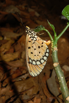
The Butterflies of western Ghats, (Goa-India region) Photos by. Arnold Noronha

The Western Ghat, Overview

The Western Ghats of southwestern India and the highlands of southwestern Sri Lanka, separated by 400 kilometers, are strikingly similar in their geology, climate and evolutionary history. The Western Ghats, known locally as the Sahyadri Hills, are formed by the Malabar Plains and the chain of mountains running parallel to India's western coast, about 30 to 50 kilometers inland. They cover an area of about 160,000 km² and stretch for 1,600 kilometers from the country's southern tip to Gujarat in the north, interrupted only by the 30 kilometers Palghat Gap.

Sri Lanka is a continental island separated from southern India by the 20-meter-deep Palk Strait. The island, some 67,654 km² in size, has been repeatedly connected with India between successive interglacials, most recently until about 7,000 years ago by a land bridge up to about 140 kilometers wide.

The Western Ghats mediates the rainfall regime of peninsular India by intercepting the southwestern monsoon winds. The western slopes of the mountains experience heavy annual rainfall (with 80 percent of it falling during the southwest monsoon from June to September), while the eastern slopes are drier; rainfall also decreases from south to north. Dozens of rivers originate in these mountains, including the peninsula’s three major eastward-flowing rivers. Thus, they are important sources of drinking water, irrigation, and power. The wide variation of rainfall patterns in the Western Ghats, coupled with the region’s complex geography, produces a great variety of vegetation types. These include scrub forests in the low-lying rainshadow areas and the plains, deciduous and tropical rainforests up to about 1,500 meters, and a unique mosaic of montane forests and rolling grasslands above 1,500 meters.

Precipitation across Sri Lanka is dependent on monsoonal winds, resulting in much of the island experiencing relatively low rainfall (less than 2,000 millimeters per year), except for the south-western “wet zone” quarter, where precipitation ranges to as much as 5,000 millimeters per year. While dry evergreen forests occupy almost the entirety of the “dry zone,” dipterocarp-dominated rainforests dominate the lowlands of the wet zone, and some 220 km² of tropical montane cloud forest still persist in the central hills, which rise to a maximum altitude of 2,524 meters.


Photos of the Day


Photo by: Gurudas Kamat Title-alone but together. A ferryboat plying between Diwar island and Ribandar

Photo by: Gurudas Kamat, Title- Goa at Dusk The people return home to Diwar Island waiting for the Ferryboat


Photo by: Gurudas Kamat, Title- In
search of holi peace
shot at Mahalaxmi Temple at Kolhapur-Maharashtra

Monday, June 2, 2008

Retiring for the Day!


Photo by- Arnold Noronha

Evening in the Western Ghats, India


Photo-© Gurudas Kamat

Tuesday, May 27, 2008

Flowing with Mhadei


About the Documentary ‘Flowing with Mhadei’

Karnataka, the neighboring state of Goa in India, in the name of development, plans to choke this very lifeline of Goa. It plans to construct a number of dams and tunnels in this eco fragile and seismic zone, and recharge its depleting river basins caused due to its own gross mismanagement and deforestation. The documentary is produced by an NGO, ECHOGOA and attempts to focus on how such ill thought and shortsighted human intervention would have long term catastrophic and irreversible effects on the human life and environment, not only in Goa and Karnataka in India, but the world as a whole.


Photo: Director and Cinematographer Gurudas Kamat on assignment.

Ecology of Mahadayi River basin

Ecology of Mahadayi River basin: An overview
By Dr. Nandkumar Kamat

IT was late Pleistocene. The ancestors of modern Homo sapiens were descending south of the Vindhyas. Many followed the river valleys-Godavari, Krishna, Bhima. A few travelled down the resource rich Ghattprabha and Malprabha rivers. From there it was the call of the Arabian Sea and the search for sea-salt which brought these ancient humans to the valleys of Mandovi and Zuari.
About hundred thousand years ago, the nomadic humans entered Goa and dispersed along the trails linking the river banks to the plateaus and the coast. The prehistory of Goa is intimately linked to the ecological history of rivers. At no point of time in their thousand hundred years history, the Goans thought that they would be deprived of the sacred waters of their life line river Mandovi. But the inevitable is likely to happen. The next two weeks would be crucial for the ecological destiny of Goa.
Although Karnataka is a friendly state, its government is allegedly hell-bent to proceed with its plan to build dams on the Kalsa and Bhanduri tributaries feeding the Mahadayi river despite consistent objections from Goa since 1985. The aim is unauthorised inter basin transfer of water from Mahadayi basin to Malaprabha basin. Mahadayi river becomes Mandovi river past Ganjem village in Goa. The ecology of Mahadayi basin is already very fragile on account of massive deforestation and quarrying in Khanapur district of Karnataka. The basin falls in the Western Ghats -a hot spot of megabiodiversity.

The Bhimgarh-Krishnapur limestone caves on Goa-Karnataka border is the only shelter in the world for the rare Wroughton's free tailed bats. The Mahadayi river basin supports hitherto unexplored flora and fauna. For Goa, the freshwater flows from the catchment in Karnataka are essential for maintaining the delicate balance between the saline estuarine zone-from Aguada to Ganjem and the freshwater zone beyond Ganjem.
The Mandovi is an interstate river basin draining area in Karnataka, Maharashtra and Goa. The Basin (1,580 sqkm drainage area in Goa) occupies 42.70 per cent of the total area of the state. The river rises in Jambotighat, about 10 km north-east of Sonasagar in Khanapur taluka, Belgaum, Karnataka at an elevation of about 940 meters above Sea level. The basin lies between latitudes 15 degree 15'24” N and 15 degree 42'00” N and Longitudes 73 degree 45'46” E and 74 degree 24'54” E. The total length of the main river is 87 km, out of which initial 35 km is in Karnataka and the balance 52 km in Goa.
The Mahadayi river in Karnataka is joined by three important tributaries namely the Bail Nadi, the Kotni Nadi and the Bhandura. There are five important tributaries forming the Mahadayi/Mandovi river in Goa portion, namely Surla (or Nanode Nadi), the Ragda, the Dicholi, the Mapuca and the Khandepar (or the Dudhsagar). The Mahadayi / Madei / Mandovi drains a total area of 2,032 sqkm of which initial 375 sqkm in East and North East and South East in Karnataka, 77 sqkm in North East portion of the basin in Maharashtra and the balance 1,580 sqkm in Goa. The basin receives 3,000-5,000 mm rainfall during the monsoon periods extending from June to November. There are 17 rain gauge stations in and around the basin. The stations inside Karnataka are Supa, Khanapur, Kankumbi, Jamagaon, Amgaon and Castlerock. In Maharashtra there is one at Tilariwadi, whereas Goa has stations at Panaji, Sanguem, Margao, Quepem, Mapusa, Bicholim, Valpoi, Ponda, Colem and Marmugao.
The Karnataka government claims that Goa is “criminally wasting'' the Mahadayi water resources. On the contrary, Goa was constantly assessing its ecological needs and the feasibility of constructing small dams and also designs of mini-hydel projects. Goa did not want to pay the heavy price of deforestation and ecological damage which Karnataka government had paid for constructing dams on western flowing rivers such as Kali and Sharavathi. Goa had planned the Mandovi Irrigation Project in the 70s at Nanode village in Sattari taluka. It was supposed to bring under irrigation a command area of 5,902 ha with an annual irrigation of 13,110 ha of land in Sattari and Bicholim talukas. The project was cleared by the Central Water Commission and the Planning Commission. But the ministry of forests and environment did not give the clearance under the Forest (Conservation) Act 1980 probably because it had apprehensions about the submergence of a large, rich forest area under the reservoir. The ecology of Mahadayi basin is very delicate. Karanatka government feels that diverting 7.56 TMC of water would not make a big difference to Goa. This is not true. The freshwater flow from Mahadayi maintains Mandovi. A simple definition of an estuary is an extension of the arm of the sea. What would happen if the freshwater flow is reduced? For some time no changes would be instantaneously noticed. But as time passes, the estuarine front would move deeper, past Ganjem and it could also affect the Zuari basin through the linking Cumbharjua canal. What would be the impact of the advancing salinity front? There would be a drastic change in the ecology, the flora and fauna of Mahadayi/Mandovi basin. If large part of the 52 km long stretch of Mandovi river is rendered saline then the freshwater availability in Goa would be reduced.
The central government, the Planning Commission and funding agencies like the World Bank need to appreciate that unlike the government of Karnataka, Goa is not in a tearing hurry to sacrifice the fragile ecology of the rivers to support large dams. Mahadayi catchment in Karnataka must be left undisturbed. The future of Goa's ecology depends on it. Karnataka government must pay more attention to demand side management, rainwater harvesting, controlled irrigation and better reservoir management instead of arm twisting a small lower riparian state like Goa anxious to conserve its fragile ecology at any cost. Goa has the capacity and is determined to harvest its water resources judiciously.

Wednesday, May 21, 2008

Goa Ethnic fish catching art and skill

'Raponkar' is a traditional fishermen community from Goa-India. still adopting its age-old technique of setting a net near the sea shore to trap fish. unfortunately with decreasing fish catch, added with total loss of revenue due to mechanized boats, the Raponkar' family is finding it difficult to survive in today world of Globalized economy. the film here depicts the traditional and ethnic way of fishing.


Tuesday, May 20, 2008

The 'Dhangar' Tribe


Photos: The Dhangar tribe
© Gurudas Kamat


The Dhangar community of nomadic buffalo herders inhabit the reserved forests of the western Ghats of Goa and surrounding, and can be seen tending to their buffaloes in the grassy plains and winding rivers.

The Temple of Tamdi Surla, around 700 AD, built by Kadamba dynesty


Photo: © Gurudas Kamat

echogoa welcomes all


Above photo: Breathtaking view of 'barajanacho' waterfall.
© Gurudas Kamat